
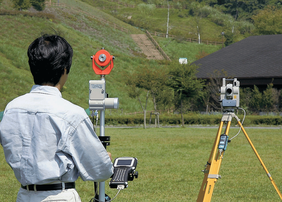
Field survey
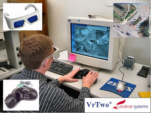
Photogrammtry
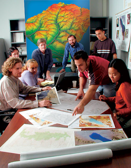
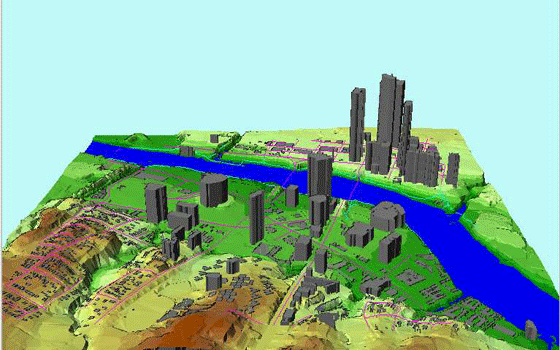
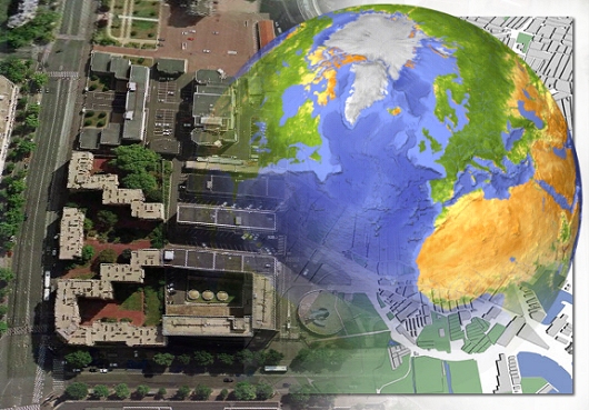
Geographic information systems
Fleet management system
Gis
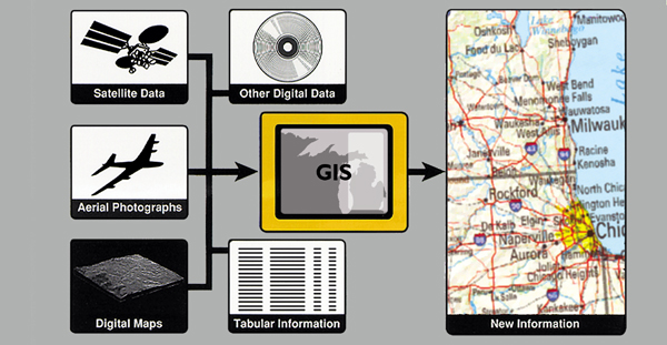
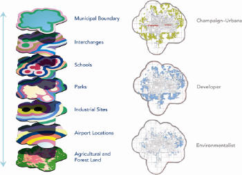
System depends on the geographic data through the program or several programs allow the storage of information and format and composition, and thus serve the information processing and representation of data is visible. Objectives of GIS is essential to take any of the appropriate decisions to accomplish the various activities of investment and infrastructure development and to identify the sectors which are economically feasible and provide data and information through a geographic information system developed, which works to advance the country's development, and support the capacity of the national economy and raising the efficiency.
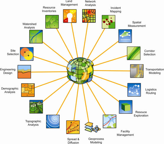
GIS has proved of real value in the business, and return on investment. During the past 30 years used by companies and agencies, academic institutions and governments around the world GIS programs to take advantage of these benefits are also used GIS effectively in solving problems and improving processes in various industries and disciplines.
Business
Learn the best ideas about how the applicability of GIS in your organization and your field.
Banking
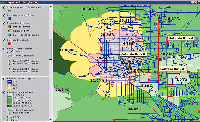
GIS employs to target financial markets through the development of perception of the needs of the service branch bank selection of places and the focus and the spread of the service at a particular place. And rely on GIS programs to help them improve operational excellence and profitability
Insurance
Many insurance companies have made GIS a key element in their work, and use it to visualize, analyze and distribute risk
Logistics
Logistics management requires the planning of activities, including fleet distribution and location of the road and tables, this is through the use of geographic information systems and logistics solutions are used under the guidance of geographic information systems to clarify the right to increase the daily number of births without increasing resources.
Media
The use of GIS is through the offices of the media to analyze everything from the circulation, and attract advertisers to create the maps used in the same article. , And the National Geographic Society using antipersonnel GIS software to draw accurate maps quickly for magazines, newspapers and online news services.
Real Estate
Real estate agencies rely heavily on electronic maps. And the use of GIS in the field of commercial real estate, to bring the maps on the Internet, shopping, work on the development of this major development investment in real estate investment trusts.
Retail
Based companies in this field are increasingly GIS to organize analyze and present data and their companies use to maintain information about sales, customers, inventory, demographic profiles, and mailing lists and with geographic locations for the distribution of sales
Government
National Government
The government has confidence in the technology of geographic information systems for policy development, organizing and promoting the welfare of its citizens. GIS is also a smart way for agencies to provide general information, in the United States relied heavily on this technology to evaluate the results of the U.S. Census in 2000. As adopted by the packing center and Statistics in Egypt in the 2006 census and uses of GIS in the general plan to link documents and image files to map the features of the state to see the integrated information
Local Government
Local government uses geographic information systems in revenue collection, economic development, and also provides information for many municipalities. To provide many city services, In Braganza is a small town in Austria, uses GIS to meet the needs of government departments of 12 provinces.
Homeland Security
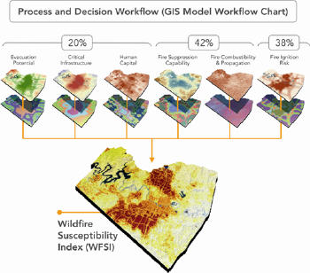
Geographic information systems used in the asset at the local, regional and national emergency response in the areas of disclosure of risk mitigation, and evaluation, prevention, preparedness, response and recovery. As used in both natural and synthetic, have merged geographical information systems in the operating procedures common for public safety and response activities emergency
Military Defense
Military defense uses GIS to analyze the terrain and intelligence, and mission planning, and facilities management. Geographical analysis and critical in military operations and planning tactical or logistical support, and infrastructure management.
The field of fire / emergency medical services
GIS allows for the staff of public safety planning for effective response to emergencies, and prioritization of mitigation and analysis of historical events, and predict future events, and uses geographic information system to get the fastest and shortest route to get to the accident in a state of emergency to help.
Law Enforcement
GIS is an effective system to combat crime. Police analysts use GIS for planning and modeling of the event, and tactical and strategic planning, and draw the scene. Police Department, gives an all police officers the necessary information on crime throughout the city. And places focus crime.
Health
GIS can follow the geography of public health indicators, identify disease clusters, and explore the sites for environmental hazards. For example, public health departments use GIS programs to reduce mosquitoes in the state of Pennsylvania Web site provides online for its West Nile virus surveillance.
Transportation
GIS serves three distinct transportation needs: infrastructure management, and fleet management, logistics, and management of transit. GIS provides a vision of network planning and analysis, vehicle tracking and routing, inventory tracking, and analysis of path planning, in the city of Budapest, relies heavily on GIS to help in the planning and coordination, management and completion of restoration work at the appropriate time
Education and Science
Research
GIS is an ideal tool to help researchers model the real world for the classification and control phenomena, and predicted changes over time, the data models making it easier to work with data layers to monitor relationships and explore new ways to represent the world around us
Libraries and Museums
GIS creates maps for an interactive museum exhibits that help visitors explore the people, places and events. GIS is also a valuable tool used by research scientists and researchers in the museum to increase people's understanding of natural systems and human cultures from anthropology to zoology GIS is used in the museum to study the levels of algae in the Gulf of Mexico.
Education
Geographic information systems help learners of all ages understand the ways geography and geographic information systems helps students and teachers to participate in studies that require and promote critical thinking, integrated education, multiple intelligences, and at any level.
|
.jpg)
|
.jpg)
|

|
|

|

|
.jpg)
|
|
|
|
|
.jpg)
|
|
.gif)
|
|

|
|
|
|
|
|
.jpeg)
|
|
|
.jpeg)
|

|
.jpg)
|